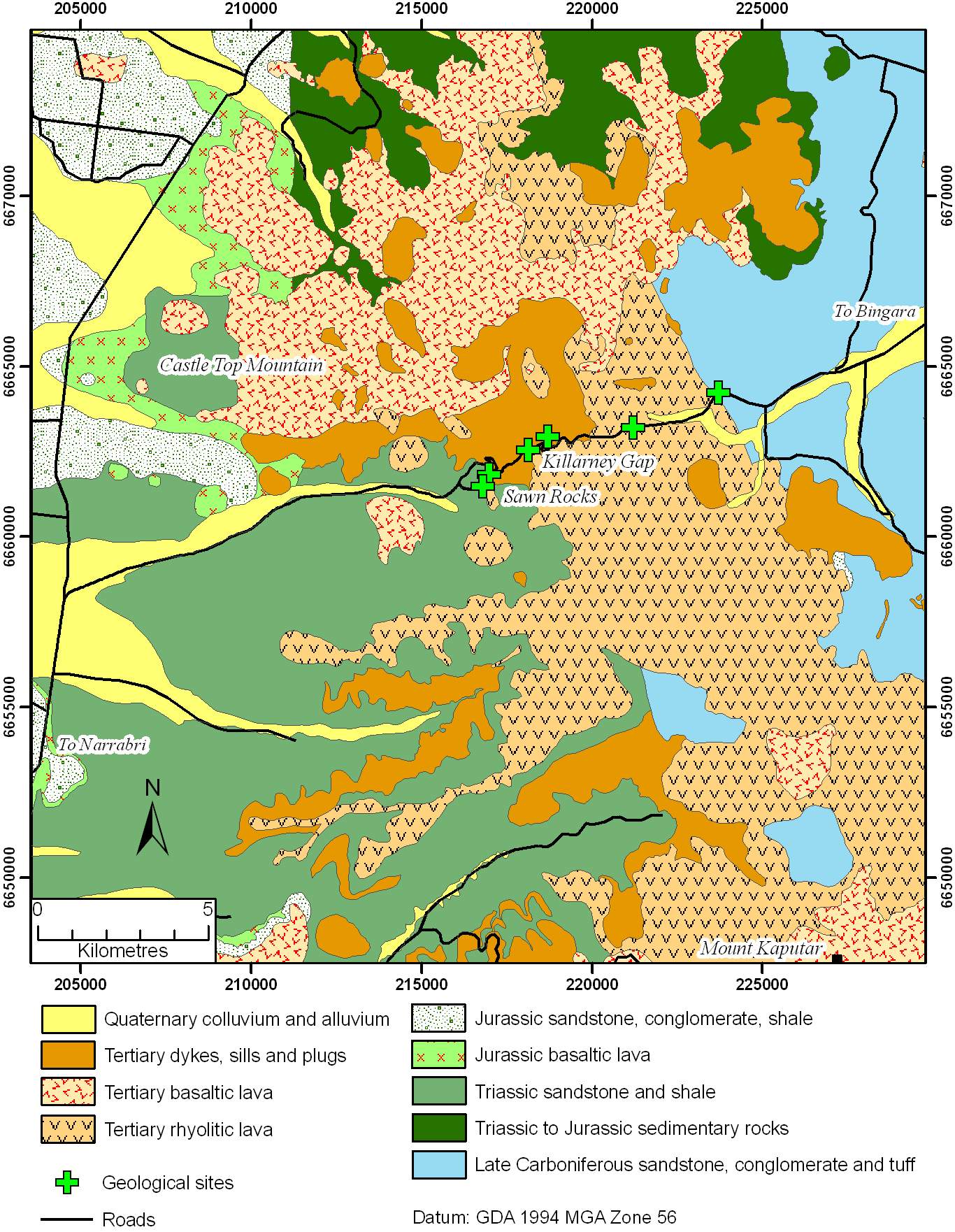
The Nandewar Volcano was a shield volcano active between 17 and 21 million years ago between Narrabri and Bingara. The volcano was developed above a mantle hotspot and produced lavas ranging from rhyolitic to basaltic in composition. The Warrumbungle Mountains were derived from magmas formed from the same hotspot as the Nandewar Volcano. The volcano sits above a major crustal fault which separates rocks of the coal and hydrocarbon-bearing Sydney-Bowen Basin on the west, from rocks of the Tamworth Belt on the east.
This drive examines easily accessible, representative rocks of the Nandewar Volcano and some of the rocks forming its basement along the Narrabri-Bingara road. The origin and history of the volcano are described, and some elements of the landforms examined. The magnificent columnar joints of Sawn Rocks are an essential stop on this photogenic drive.
A more detailed map of the route (shown at left) may be downloaded by clicking on the map image.