
Download Manilla geological tour 630Kb
Similarly to Barraba and Bingara, the small village of Manilla is located on the Fossickers Way in the western New England area of northern New South Wales. Manilla is situated in picturesque country typifying rural inland eastern Australia. Despite its small size, the town supports a significant tourism trade, largely assisted by the many events centred about gliding, hang gliding and parafoil sports.
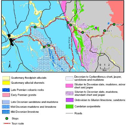
Our revised and expanded (as of August 2008) geological tour travels eastward from the town in a looped round trip of 70 km, passing through tilted and folded marine sedimentary rocks, then crossing the Peel Fault with its associated serpentine. Older, very deep-water marine sedimentary rocks, limestone and granite occur on the eastern side of the fault. The route passes through some classic Australian countryside, with beautiful scenery and interesting rocks. Most stops are sign posted, with the exception of new Stops 7 and 8.